Saving Koalas Affected by Bushfires
Drones in the hands of professional firefighters and authorized volunteers played a significant role in fighting the fires in Australia. In the aftermath, drones have taken on a new role to help restore Australia’s wildlife.
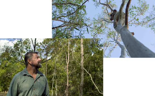
Victoria’s forest and wildlife officers, with the help of the Australian Defence Force, are using drones and infrared technology in a search and rescue operation for koalas affected by recent bushfires. A drone scans for signs of life, captures images, and sends them back to an inspection van. The officers then review these images to assess if further healthcare is required before stepping in.
In a similar case, researchers at the Queensland University of Technology are using a DJI drone to automate the detection of koalas over vast tracts of bushfire-affected areas. With the addition of a DJI Zenmuse XT2 thermal camera, the team can cover more ground and spot koalas hidden in trees more accurately, making their census work with greater efficiency.

Predicting and Preventing Urban Accidents
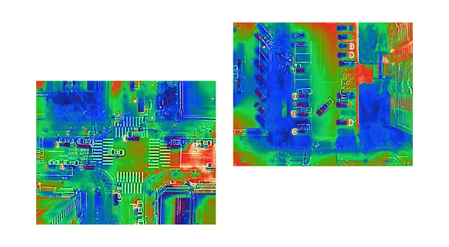
Thermal cameras haven’t just proved their worth in saving endangered species. City officials in Seongnam are using this technology with a birds-eye-view of city streets, aimed at hot water pipes underground. In 2018, a rusted pipe burst, spewing a column of 110° C water into the street, killing one and injuring 26. These eyes in the sky can identify similarly weakened pipes and prevent another accident.
Using drones for public safety has seen a boom in the city in recent years. Fifty-two departments logged a total flight time of over 55 thousand minutes in 2019. The technology is also managing a range of crises. During a heatwave, officials can use a drone to track hot and cool spots and inform populations who are most at-risk for heat exhaustion. And with the rise of urban redevelopment, drones are taking photos of every village to create a digital city that lets residents return to their childhood homes.
Monitoring Volcanic Activities
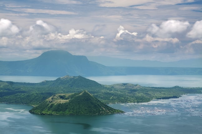
During the recent eruption of the Taal volcano in the Philippines, footage from a drone revealed smoke from the crater taken on January 15, 2020. The volcano started spewing lava four days later, forcing nearly 40,000 people from their homes. Towering dust columns clouded nearby towns, ash blanketed houses and roads, and damage from the eruption disrupted local agricultural production. While the recovery efforts on the ground are well underway, aerial footage provides government and public safety agencies critical information to assess affected areas more quickly and accurately.
Furthermore, traditional instruments planted at active sites are easily exposed to damage, leaving volcanologists with a blindspot. Instead of assigning volcanologists to risk their lives to install replacement devices, they can fly near and above the volcano from a safe distance. From this vantage point, they can obtain all the vital information they need for rescue and recovery, as well as future disaster prevention.


P.S. – We want to hear from you! Please let us know what you would like to read from us by clicking here. We look forward to your comments.